Central California means different things to different people, but for travelers, it almost always comes down to the same stretch: the coast between San Francisco and Los Angeles, where Highway 1 winds past sea cliffs and redwoods, where the seafood is as fresh as anywhere in the country, and where a single day can move you from a tide pool to a wine tasting to a summit trail. This region covers the Central Coast from Santa Cruz and the Monterey Peninsula south through Big Sur, San Luis Obispo, and Santa Barbara, with a national park tucked inland that most visitors skip entirely. Whether you have three days or ten, here is what is worth your time.
The Monterey Peninsula
Monterey is the easiest entry point into central California, and it earns its reputation. The Monterey Bay Aquarium is the anchor attraction, a genuinely serious marine science institution with exhibits on open-ocean species, giant kelp forests, and the sea otters that float in a small tidal pool near the entrance. Give it half a day and do not rush the jellyfish gallery. Tickets run around $55 for adults and $35 for children and are worth booking in advance on summer weekends.
Outside the aquarium, Cannery Row trades on its Steinbeck history but is mostly shops and restaurants today. The real payoff is the adjacent recreation trail, a flat path along the bay where harbor seals haul out on the rocks and sea otters crack shells in the kelp beds offshore. It runs about five miles from Lovers Point in Pacific Grove to Fisherman’s Wharf, and you can walk or rent a bike at either end.
A mile south of Carmel, Point Lobos State Natural Reserve is one of the best short hikes on the coast. The Sea Lion Point Trail, about 0.6 miles, puts you above a cove where sea lions chorus on the rocks below. The Cypress Grove Trail winds through a Monterey cypress forest clinging to the headland. Entry is $10 per vehicle, and the lot fills before 9 a.m. on summer weekends, so either arrive early or park outside on the highway and walk in.
Carmel-by-the-Sea itself is a small, walkable village with galleries, bakeries, and a beach where leashed dogs are welcome year-round. The beach is wide and sandy, the water cold. A bowl of clam chowder at one of the bread-bowl spots on Ocean Avenue, then a walk down to the beach and back, is about 90 minutes well spent.
For the deeper look at Monterey and Carmel, the place page covers the individual neighborhoods, whale-watching season, and the 17-Mile Drive.
Big Sur
Big Sur begins roughly where the highway bends south out of Carmel and runs about 90 miles to San Simeon. You will not cover it fast. On a clear day with stops, plan for five to six hours. The road is two lanes, the pullouts are small, and the shoulder drops to a cliff in places. This is not a stretch you drive while distracted.
The stops that earn the time: Bixby Creek Bridge about 13 miles south of Carmel, with the best pullout on the north side for the photo. Julia Pfeiffer Burns State Park for the short walk to McWay Falls, an 80-foot waterfall that spills onto an empty cove beach. Pfeiffer Big Sur State Park for riverside redwood trails if you want to be out of the car for more than 20 minutes. And Jade Cove near the southern end, where you can legally collect nephrite jade from the surf line below the mean high-tide mark.
Check highway conditions before you go. Big Sur closes with regularity after winter storms, sometimes for weeks, and getting turned around at a roadblock after a long drive is a common traveler frustration. Caltrans posts current status at quickmap.dot.ca.gov. Our Big Sur travel guide covers the specific stops, camping options, and how to plan around closures. The best time to drive Highway 1 breaks down the fog and traffic patterns by month.
San Luis Obispo and Morro Bay
San Luis Obispo, or SLO as locals call it, sits in the middle of the region and makes a practical base. Downtown is compact, walkable, and anchored by the Mission San Luis Obispo de Tolosa, one of the better-preserved California missions, with a small museum and a courtyard that is open year-round. The Thursday night Farmers Market on Higuera Street draws the whole town and runs until about 9 p.m., with barbecue smoke, local produce, and street performers filling several blocks.
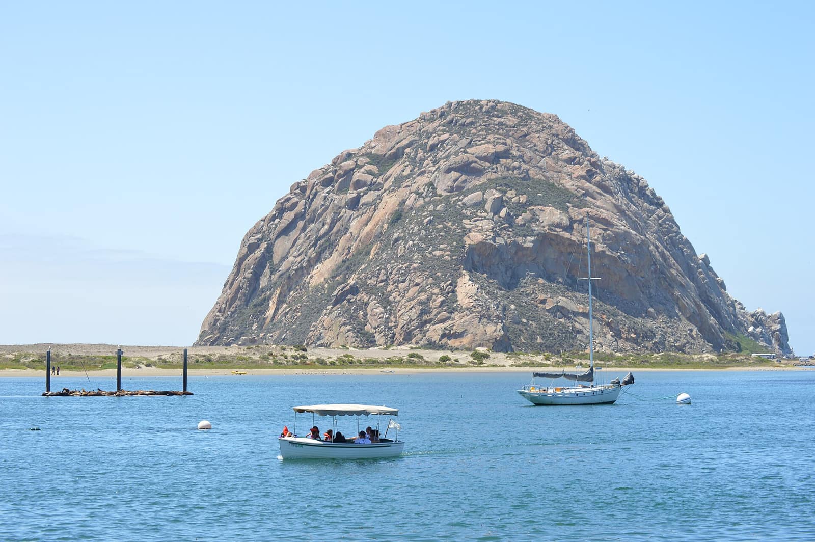
About fifteen minutes west on Highway 1, Morro Bay is the quieter version of a California beach town. The defining feature is Morro Rock, a 576-foot volcanic plug that sits at the harbor entrance and is protected as a falcon sanctuary. You can drive to the base for the view, kayak the estuary where otters feed among the eelgrass, or walk the embarcadero for fish and chips with a harbor view. Kayak rentals run around $20 to $30 an hour from shops on the embarcadero. The broader Morro Bay State Park system includes tidepools at Hazard Canyon Reef and a coastal dune trail that runs north toward Morro Strand State Beach.
Paso Robles Wine Country
About 30 miles north of San Luis Obispo on US-101, Paso Robles is California wine country for people who find Napa too crowded and too expensive. The region grows about 60 grape varieties across more than 200 wineries. Zinfandel, Cabernet Sauvignon, and Rhone varieties like Syrah and Grenache are the strengths here. Most wineries open daily from 10 or 11 a.m. to 5 p.m. and charge $15 to $20 for a standard tasting; some waive the fee with a bottle purchase.
Downtown Paso Robles centers on a tree-shaded square with restaurants, a wine bar or two, and most of the tasting rooms within walking distance. A self-drive loop taking you west toward Templeton and then back east covers the highest density of well-regarded producers in half a day without committing to a tour. If you want to go deeper on California wine country, the full guide covers Napa and Sonoma, though Paso is a distinct style from both.
Santa Barbara
Santa Barbara sits at the southern end of the central California coast, about two hours north of Los Angeles on US-101. The Spanish Colonial architecture, the palm-lined State Street corridor, and the red-tile rooftops of downtown are a distinct California look. The Santa Barbara Mission, built in 1786, is the best-preserved of the California missions and is still an active parish. Self-guided tours of the grounds and museum run about $10.
The city beaches are clean and calm, with the downtown waterfront about a five-minute walk from State Street. Leadbetter Beach is the local favorite for swimming; East Beach runs longer and has volleyball courts. The Santa Barbara Harbor is where the whale-watching and Channel Islands ferry boats launch, and even a short walk out on the breakwater gives you harbor seals hauled out on the rocks.
From Santa Barbara, the Channel Islands National Park is reachable by a one-hour ferry to Santa Cruz Island from Ventura, about 35 miles south on US-101. Island Packers Cruises runs daily trips in season, with round-trip tickets around $60 to $80. Santa Cruz Island has sea caves and kayak routes, a campground, and the endemic island fox, a small distinct species that lives only on the Channel Islands. Day trippers need to book ahead in summer; the ferries fill fast.
For the full rundown on Santa Barbara, the place page covers the wine trail and the neighborhoods east and west of downtown.
Pinnacles National Park
Pinnacles is the central California park most visitors skip, and that is a reason to go. Located about 35 miles east of Salinas on Highway 25, it is the eroded remains of an ancient volcano that drifted north from Southern California on the San Andreas Fault over millions of years. What is left is a landscape of spires, talus caves, and boulder scrambles in what looks like it was dropped in from another planet.
The talus caves, where you scramble through cracks between massive fallen boulders, require a headlamp and some comfort with tight spaces. Bear Gulch Cave and Balconies Cave are the two main routes, and the cave trails combine easily with ridge hikes of 5 to 8 miles for a full day. The park is one of the best places in California to see California condors in flight, the result of a long-running reintroduction program that has brought the species back from 27 individuals in the 1980s to a wild population of several hundred. The NPS Pinnacles site has current condor sighting reports.
Go in spring (March through May) for wildflowers on the hillsides and moderate temperatures, or in fall (September through November) when the summer heat breaks. Summer at Pinnacles is genuinely hot, and the cave trails can be closed during peak bat maternity season. Admission is $30 per vehicle. The west entrance at Chalon Road is the scenic approach; the east entrance near Hollister has more campsite options.
When to Go and How to Get There
The central California coast is accessible year-round, but the timing shifts the experience. Spring (April through June) brings the greenest hillsides and the most wildflowers, and Big Sur and Pinnacles are at their best. Summer is the busiest window, with June Gloom affecting coastal mornings through early July before burning off. Fall, September through November, is the warmest and clearest on the coast, and the crowds are thinner. Winter closes some higher trails and brings storm risk to Highway 1, but the gray-whale migration runs December through April and whale-watching tours go daily from Monterey and Santa Barbara.
San Francisco (SFO) and Los Angeles (LAX) are the logical gateway airports, each about 3 to 3.5 hours from Monterey by car. Amtrak’s Pacific Surfliner connects Los Angeles to Santa Barbara with several daily trains and is a reasonable option for the southern end. Beyond that, a rental car is the only practical way to cover the full region. Set your trip dates using the California travel guide’s seasonal breakdown, and build your route south to north or north to south depending on which gateway you fly into.