Highway 1 is beautiful in any month it is open, but the coast does not look the same all year. Summer brings fog that can hide Big Sur entirely, winter brings rain and the landslide closures that shut the road for weeks at a time, and a few weeks in fall deliver the clear, warm, uncrowded coast everyone hopes for. If you can pick your dates, this is the drive to plan around the weather rather than your calendar. Here is how the seasons play out on the Pacific Coast Highway, and when to go. The full Driving Highway 1 and the Pacific Coast planner covers the route itself; this is about timing.
Month By Month At A Glance
If you already know your travel window, here is how each stretch of the year plays out on the Central Coast, roughly the Monterey to San Simeon run where the drive is at its best and its most weather-dependent.
| Months | Coast weather | Crowds | Closure risk | Verdict |
|---|---|---|---|---|
| Dec–Feb | Cool, 55–62°F, rain between storms | Lowest | Highest | Cheap and dramatic, but risky |
| Mar–May | Green hills, 58–66°F, some fog | Building | Moderate | Underrated if the road is open |
| Jun–Aug | Warm inland, foggy coast, 60–68°F | Highest | Low | Busy and often gray |
| Sep–Oct | Clearest, warmest, 65–75°F | Dropping | Low to moderate | The sweet spot |
| Nov | Cool, first rains possible, 58–64°F | Low | Rising | A quieter gamble |
The pattern that surprises people is that the two most popular months, July and August, are also the foggiest, while the shoulder months on either side of them deliver better light. Plan around that and you have already made the single best timing decision for this road.
Fall Is The Sweet Spot: September And October
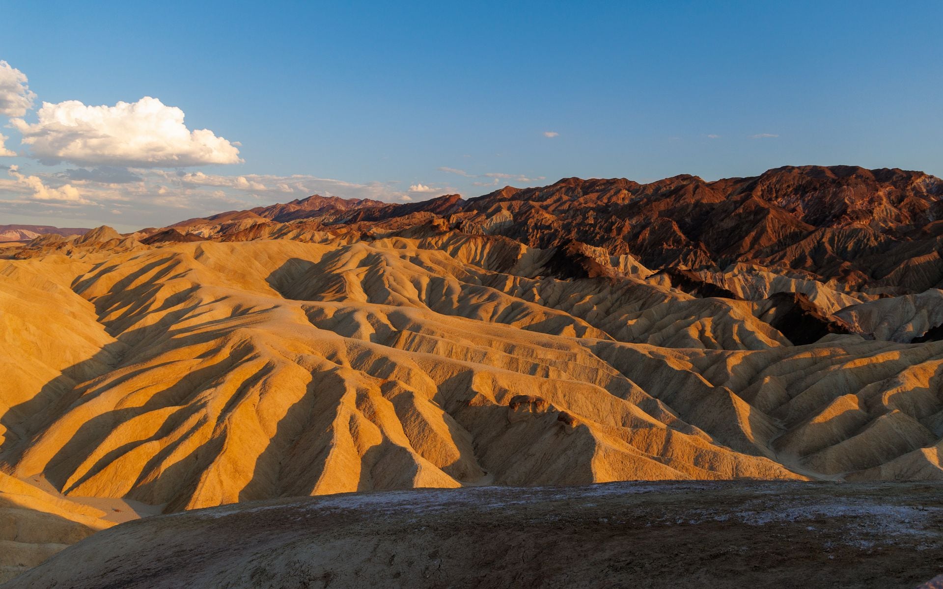
September and October are the best weeks to drive Highway 1, full stop. The summer marine layer that grays out the coast finally thins, so you get clear views over Bixby Creek Bridge and down to McWay Falls in Julia Pfeiffer Burns State Park instead of a wall of fog. Daytime temperatures on the Central Coast sit in the comfortable 65 to 75 range, the summer crowds have gone home after Labor Day, and the rains have not started. Point Lobos State Natural Reserve near Carmel and the elephant seal beaches at Piedras Blancas are easy to enjoy without fighting for a turnout, and the tasting rooms and beaches around Monterey and Carmel are quieter than they have been since spring.
There is a bonus in these months that most planners miss: this is when the coast is warmest. The northern and central California coast runs its warmest, clearest weather in September and October, not July, because the summer upwelling that drives the fog finally eases. So the shoulder season here is not a compromise, it is the peak. If you can only take one week to drive the road, take it now.
The one catch is that fall is also wildfire season in California, and smoke or a road closure can appear on short notice. Check current conditions the week before you go. But if you are optimizing for clear coast and open road, aim for late September through mid-October and you will rarely do better.
Summer: Warm, Busy, And Foggier Than You Expect
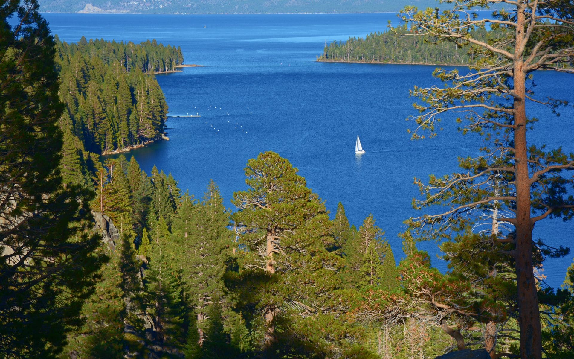
June through August is peak travel season, which means the most cars, the highest hotel rates, and, counterintuitively, some of the worst coastal visibility of the year. The California coast runs a stubborn marine layer through summer mornings, and in Big Sur it can sit all day. Locals call the wider pattern June Gloom farther south, and it is real on Highway 1 too. You can drive the whole Monterey-to-San-Simeon stretch and see mostly gray.
Summer is not a bad time to go, especially if your schedule fixes it there. The road is open, the towns are lively, and the fog often burns off by early afternoon. Just start your driving days later to let it clear, book lodging in Monterey or San Luis Obispo well ahead because rooms sell out, and set your expectations. This is also the season to lock in other reservations early, since a summer coast trip often pairs with the Sierra, and the Yosemite reservation process fills up fast in the same months.
Spring: Green Hills And Fewer Crowds
March through May is an underrated window. The winter rains green up the hills behind Big Sur, wildflowers show along the bluffs, and the crowds are far thinner than summer. Temperatures run cooler, often in the high 50s to mid 60s on the coast, and you will want a jacket at the overlooks. Fog is less relentless than midsummer but still shows up.
The thing to watch in spring is whether the road is fully open after the wet season. Winter storms often leave a closure or a one-way traffic-signal section somewhere through Big Sur into early spring, so confirm the route before you drive it. If it is clear, spring gives you some of the greenest scenery of the year with room to breathe.
Winter: Dramatic, Cheaper, And The Riskiest For Closures
December through February is the low season, and it comes with real trade-offs. Hotel rates drop, the coast can be gorgeous and empty between storms, and winter is prime whale-watching season as gray whales migrate south past the coast from December into February on their way to the Baja lagoons. This is also when the elephant seals haul out at Piedras Blancas in the biggest numbers, thousands of them on the beach right off the highway. But winter is the rainy stretch, and rain is what triggers the mudslides and washouts that close Highway 1 through Big Sur, sometimes for months. A winter trip can be spectacular or it can dead-end at a closure gate.
If you go in winter, build in flexibility. Have a fallback plan to detour inland on U.S. 101 through Paso Robles and Salinas, watch the forecast, and never try to drive the twisty Big Sur section at night or in heavy rain. The drops are real and there are no lights. For the wider seasonal picture across the whole state, weigh it against the best time to visit California.
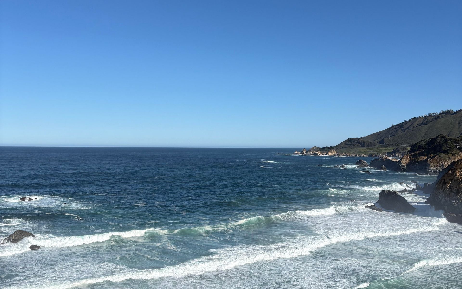
What The Fog Does To The Drive
It helps to understand the marine layer, because it is the thing most likely to disappoint you on a summer trip. It is a bank of low cloud that forms over the cold offshore water and pushes onto the coast, thickest overnight and in the morning. On a typical summer day it sits over the water until late morning, then burns back a few miles as the inland valleys heat up and pull it out to sea. By early to mid afternoon the Big Sur cliffs are often clear, and by evening the fog rolls back in.
The practical move is simple: on a foggy stretch, do not start your driving day at 8 a.m. Have a slow breakfast in Monterey or Carmel, hit the road around 10 or 11, and you give the coast time to open up before you reach the best overlooks. Reverse the logic in fall, when clear mornings are the norm and an early start beats the day-trip crowds to Bixby Bridge and McWay Falls. The fog is not a reason to skip summer, it is a reason to time your hours to it.
Common Timing Mistakes
The first is booking a summer trip expecting the postcard and getting a gray wall instead. Set your expectations, or move the trip to fall if you can. The second is assuming a clear forecast means an open road. Weather and closures are separate problems on Highway 1: a brilliant October day means nothing if a slide has the road shut at Rocky Creek, so check Caltrans QuickMap for the road status independently of the weather app. The third is cutting it too fine on daylight. Big Sur is slow, the turnouts eat time, and you never want to be threading those curves in the dark. Whatever season you pick, start early enough that you finish the twisty section before dusk.
Timing Around Cost And Closures
Two practical notes before you book. First, closures are the real wildcard on this road, not weather. Highway 1 through Big Sur has closed repeatedly in recent years for slides, so check the current status no matter the season. A clear October day means nothing if the road is shut at Bixby. Second, timing affects your budget: summer is the priciest window for lodging on the coast, and fall and spring cost noticeably less for the same drive. If you are watching the numbers, the is California expensive to visit rundown shows where the money goes.
The Short Answer
Drive Highway 1 in late September or October for the clearest coast and thinnest crowds. Take spring for green hills and fewer people if the road is open. Accept summer’s fog and prices if that is when you can go, and start driving later in the day. Treat winter as the wildcard: cheaper and dramatic, but the season most likely to hand you a closed road. Whenever you go, check for closures first, drive north to south, and give Big Sur far more time than the map suggests.