Big Sur is not a town. It is a roughly 90-mile stretch of Highway 1 between Carmel and San Simeon where the Santa Lucia Mountains drop straight into the Pacific. There is no single center, no big resort strip, and often no cell signal. That is the point. This guide covers how long the drive really takes, where to stop, where to sleep and eat, and how to plan around the closures that shut the road down more often than most visitors expect.
The Drive: Highway 1, Slower Than You Think
Google will tell you the Carmel-to-San Simeon run is about two hours. Ignore that number. With stops at the overlooks, a lunch, and the slow, curving two-lane road, plan on a full day if you want to enjoy it. The classic direction is north to south (Monterey down toward San Simeon) because that puts you in the right-hand lane on the ocean side, which makes pulling into the turnouts easy and the views immediate.
Start with a fuel top-off and a full water bottle, because gas in Big Sur is scarce and expensive when it is available at all. Expect to pay well above the state average at the pumps in Gorda and near the Big Sur River Inn, sometimes a dollar or more per gallon over what you paid in Monterey. Fill up in Carmel or Cambria before you commit to the drive.
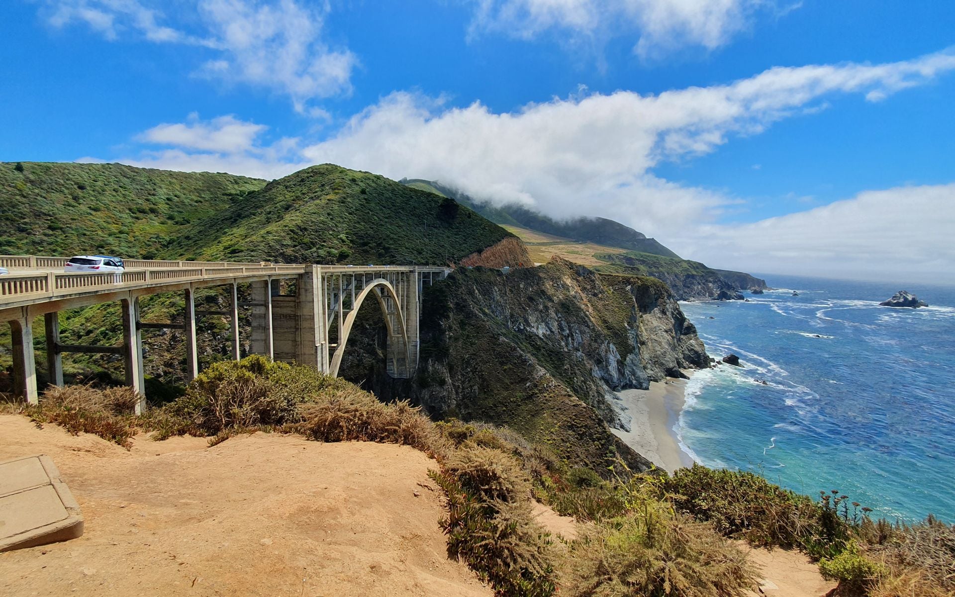
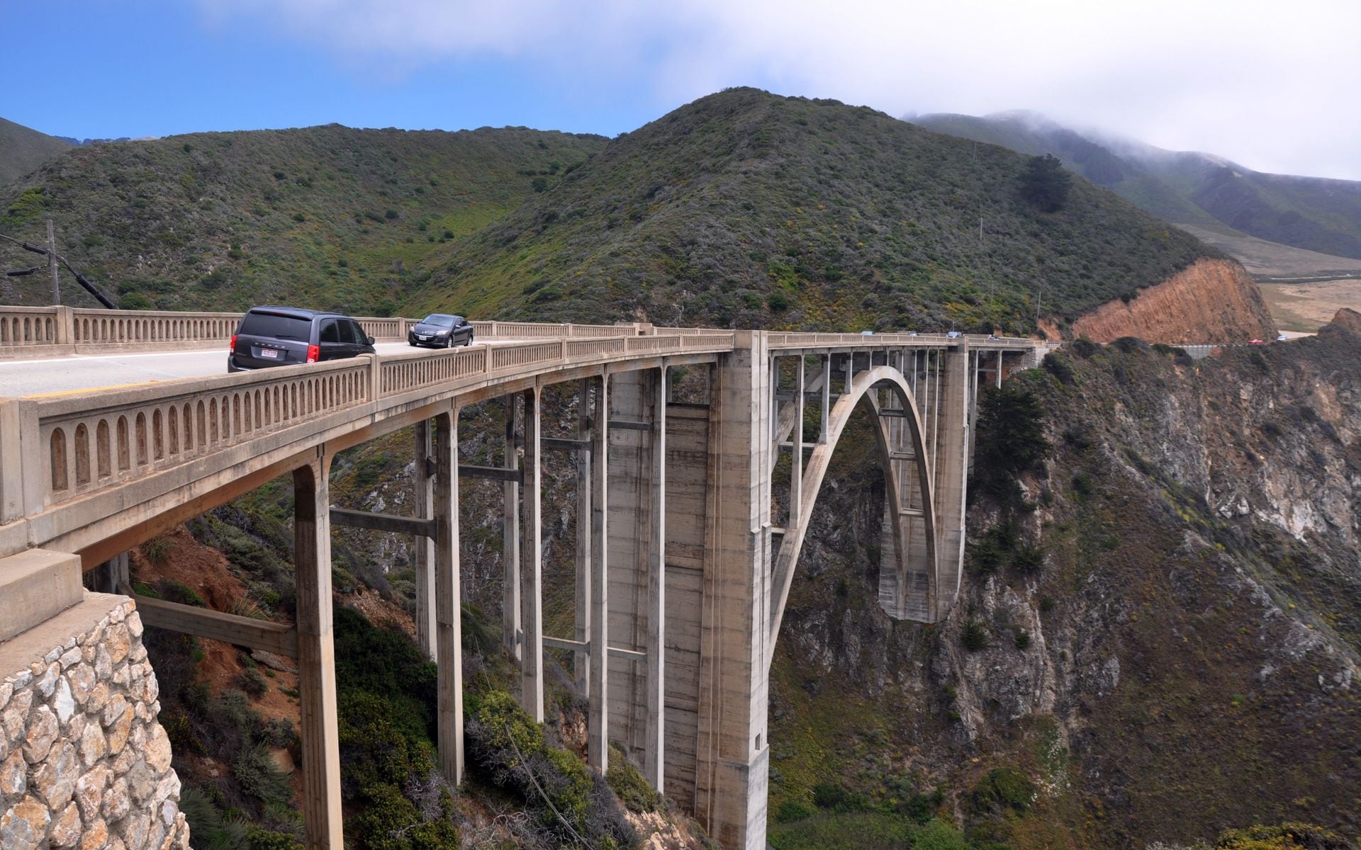
Heading south from Carmel, the stops come in a rough order. Point Lobos State Natural Reserve sits just south of Carmel and makes a strong first pull-off. Garrapata State Park a few miles down has the Calla Lily Valley (best in late winter and spring) and the Soberanes Point bluff trails, and there is no formal parking lot, just gravel shoulders along the highway. The signature stop is Bixby Creek Bridge, about 13 miles south of Carmel, with a turnout on the north side for the postcard shot; the older Rocky Creek Bridge a mile north is nearly as photogenic and far less crowded. Just past Bixby, Point Sur Lighthouse stands on a volcanic rock and runs guided walking tours a few days a week for about $15.
Farther south, Pfeiffer Big Sur State Park has redwoods and river trails, and Julia Pfeiffer Burns State Park holds McWay Falls, an 80-foot waterfall that drops onto a cove beach. You view it from a short cliff trail, not the sand. Both state parks charge roughly $10 per vehicle for day use. For the full orientation on the region and its main sights, our Big Sur page goes deeper on individual stops and trailheads.
Check the Road Before You Commit
This is the part most guides bury, and it matters more than any overlook. Highway 1 through Big Sur closes regularly. Winter storms trigger landslides, and sections have been shut for months at a time in recent years while crews rebuild the road. Before you plan a through-drive, check Caltrans QuickMap or the Caltrans District 5 updates for active closures on Highway 1 between Carmel and Cambria. If the road is closed in the middle, you cannot drive straight through, and you will need to approach Big Sur as an out-and-back from either the north (Monterey) or south (San Simeon) end.
Weather shapes the experience as much as closures. Summer brings coastal fog that can gray out the views until midday, especially in the mornings. Fall is often the clearest and warmest window on this coast. Our guide to the best time to visit California covers the seasonal pattern, and the best time to drive Highway 1 breakdown goes deeper on month-by-month fog and traffic. For Big Sur specifically, September and October give you the best odds of clear cliffs and open road. Avoid the drive right after a big winter storm, when rockfall and mud can shut sections with little warning even if the road was open that morning.
Where to Eat and Sleep
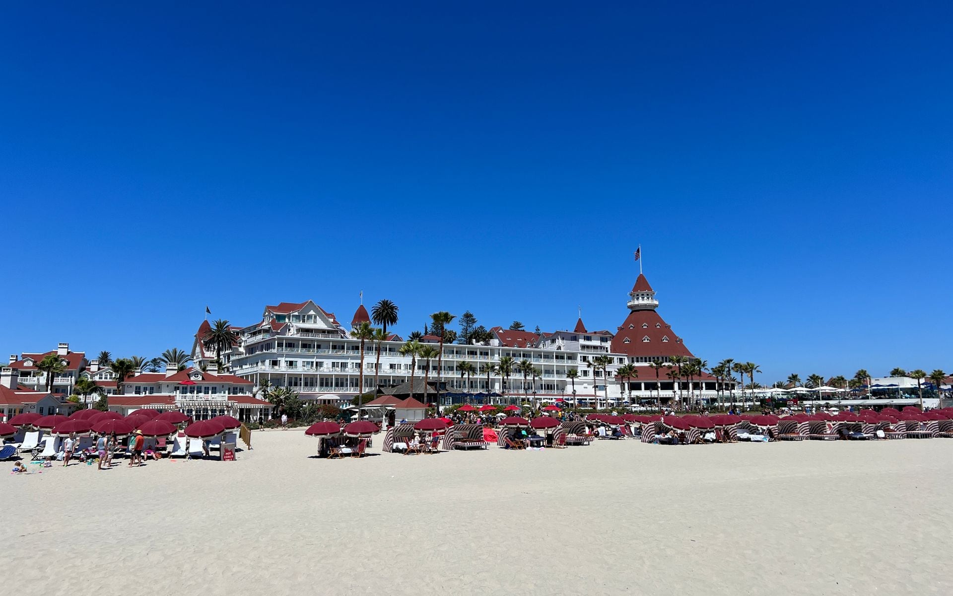
Big Sur lodging is limited and pricey, and it books out well ahead in summer. The famous names are the splurges: Post Ranch Inn and Ventana Big Sur both charge north of $1,000 a night. Below that tier, Deetjen’s Big Sur Inn is a rustic set of hand-built cabins with no TVs and thin walls, Glen Oaks Big Sur runs modernized cottages along the river, and the Big Sur River Inn and Big Sur Lodge sit in the redwoods near Pfeiffer Big Sur State Park. If you are not staying overnight, base yourself in Carmel or Monterey to the north, both about 30 to 45 minutes from the heart of Big Sur. Monterey has the wider range of hotels and puts you next to the Monterey Bay Aquarium, worth a half-day on its own.
For food inside Big Sur, Nepenthe is the name everyone knows, a cliffside restaurant perched about 800 feet above the water with a deck built for the view. The food is straightforward American fare and the prices reflect the real estate, but the setting earns it. Go for a late lunch to skip the dinner wait and catch the light. Big Sur Bakery, near the post office, does wood-fired breakfast and pastries and is the better bet for a quick, cheaper meal. The Big Sur River Inn has a casual restaurant with a creekside deck where you can sit with your feet in the water in summer. Just north, in Carmel-by-the-Sea, Point Lobos State Natural Reserve is a short detour with some of the best short coastal hikes on the Central Coast, sea lions offshore, and cypress groves on the point. It makes a natural first or last stop bookending the Big Sur drive.
Camping If the Hotels Are Full
Camping is the way most people afford a night in Big Sur, and it puts you inside the redwoods instead of an hour away. Pfeiffer Big Sur State Park has the most developed campground, with drive-in sites among the trees along the river, and it books out months ahead for summer weekends through ReserveCalifornia. Kirk Creek Campground, run by the Forest Service on a bluff at the southern end, is the standout: every site sits on an open headland right above the ocean, and it takes reservations on Recreation.gov. Andrew Molera State Park has walk-in tent sites a third of a mile from the lot for those who want it quieter and cheaper. Wherever you camp, book early, bring layers for the cold coastal nights, and pack out everything, because services are thin and dumpsters fill fast.
What to Do Once You Stop
Big Sur rewards short hikes over big-mileage days. The Pfeiffer Big Sur State Park loop takes you through redwoods along the river. Andrew Molera State Park has a longer beach-and-bluff loop for those wanting a few hours on foot. Pfeiffer Beach, reached down a narrow, easy-to-miss road, is known for its purple-tinged sand and a rock arch that frames the sunset. It has a day-use fee and fills up, so arrive early.
Pack layers regardless of season. The coast can sit 20 degrees cooler than the inland valleys, and fog rolls in fast. Bring cash for the state park day-use fees, download your maps offline before you lose signal, and do not count on finding a coffee or a restroom whenever you want one. Big Sur is thin on services by design.
The Southern Stretch and Hearst Castle
The southern half of the drive, from around Lucia down to San Simeon, sees far fewer stops and far fewer people, and it holds some of the best of the coast. Sand Dollar Beach near Plaskett Creek is the largest sandy beach on this stretch and a good spot for a long walk. Just south, Jade Cove is exactly what it sounds like: rockhounds pick through the surf line for nephrite jade, and it is legal to keep what you find below the mean high-tide line. Ragged Point marks the last real services heading south, with an inn, a gas pump, and a cliff-edge overlook.
The drive earns two payoffs near the end. The Piedras Blancas elephant seal rookery, a few miles north of San Simeon, has a boardwalk where you can stand within yards of hundreds of seals hauled out on the sand; the biggest crowds of animals show up from December through March. And Hearst Castle at San Simeon runs guided tours of William Randolph Hearst’s hilltop estate, with tickets starting around $30 and reservations recommended in summer. It makes a fitting bookend to the southern end of the drive.
Fitting Big Sur Into a Bigger Trip
Big Sur is the centerpiece of any Pacific Coast Highway road trip, and it slots naturally between the Monterey Peninsula and Santa Barbara. Our Pacific Coast Highway guide covers the full run from San Francisco to San Diego and where Big Sur fits in the larger route. Most travelers give it one full day of driving with an overnight on either end. If you are building a longer California loop, the coast pairs well with wine country and the desert parks depending on the season. Heading inland for a few days of tasting afterward is easy, and our best wineries in Napa Valley guide covers that side of the trip. If you are traveling in the cooler months and want to add a desert leg, the Death Valley when to visit post explains the seasonal window that keeps you out of the dangerous summer heat.
However you build it, treat Big Sur as a slow day, not a checkpoint. The drive is the destination here. Give it the time it needs, keep an eye on the road status, and go in the fall if you can. For the wider planning picture, the California travel guide ties the coast into the rest of the state.