What Defines the Central Coast
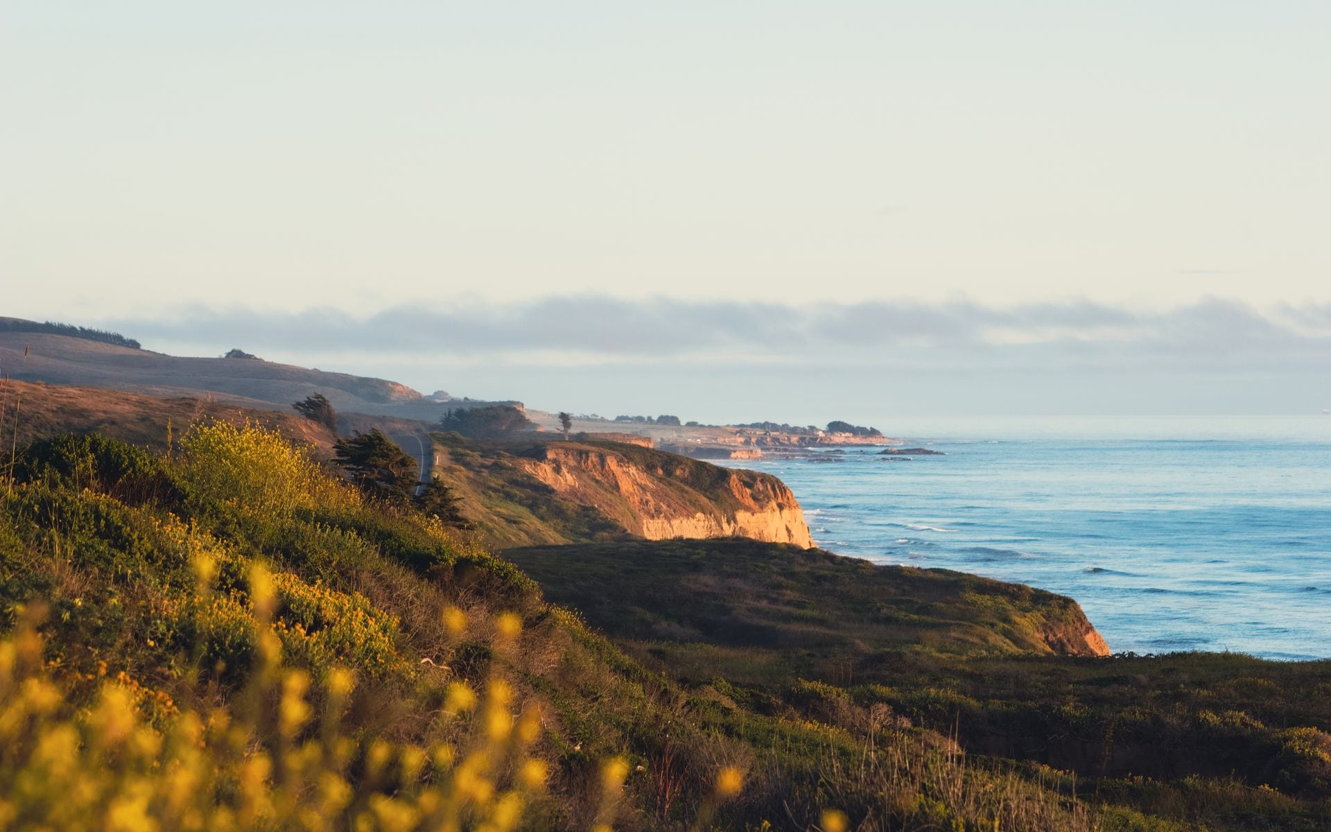
The Central Coast is the seam between Northern and Southern California, and it is where Highway 1 does its best work. From the surf town of Santa Cruz at the north end, the road runs past the Monterey Peninsula, climbs the cliffs of Big Sur, then drops toward the Spanish-flavored city of Santa Barbara in the south. Inland, the country turns to oak hills, ranch land, and vineyards. This is the part of the coast people picture when they imagine the California road trip.
The weather is mild and coastal all year, with cool, foggy mornings that often burn off by midday, especially in spring and early summer. Fall is frequently the clearest, warmest stretch on this coast, and it also thins the crowds. Winter brings rain and the biggest surf, and it is the season when Big Sur's cliffs are greenest but also when landslides occasionally close sections of Highway 1, so check current road status before you commit to the full drive. Anchor your trip with the wider California travel guide if you are still choosing regions.
The Central Coast also puts you within reach of two overlooked national parks. Pinnacles National Park sits inland east of the Salinas Valley, built around volcanic spires and talus caves, and Channel Islands National Park lies offshore from Ventura and reaches by boat. Neither draws the crowds of Yosemite, which is part of the appeal.
Main Bases and Where to Stay
Most trips base in two or three of the coast towns rather than one. Monterey and Carmel make the best northern base: Monterey has the aquarium and Cannery Row, Carmel-by-the-Sea is a walkable village of galleries and inns, and both put you at the doorstep of the 17-Mile Drive and Point Lobos. The Monterey Plaza Hotel & Spa sits right over the water on Cannery Row, and The Inn at Spanish Bay on the Pebble Beach coast is the upscale pick with links golf and fire pits at sunset.
For the middle of the drive, Big Sur itself has a handful of lodges and campgrounds strung along the cliffs, and they book far ahead and run expensive, so reserve early or plan to pass through in a day. At the south end, Santa Barbara is the most full-service base, with beachfront hotels, a walkable State Street, and its own airport.
For a broader look at how lodging prices and styles shift by region across the state, the best beaches in California guide pairs well with a coast itinerary when you are deciding which towns to overnight in.
Top Places to Prioritize
Big Sur is the headline. The 90-mile stretch of Highway 1 between Carmel and San Simeon runs along cliffs hundreds of feet above the Pacific, past the Bixby Creek Bridge, Pfeiffer Beach, and the waterfall at Julia Pfeiffer Burns State Park that drops onto the sand. Drive it slowly, use the pullouts, and give yourself the better part of a day even though the mileage looks short.
On the Monterey Peninsula, the Monterey Bay Aquarium is one of the best in the world and easily a half day, and Point Lobos State Natural Reserve just south of Carmel has short cliff-top trails over some of the clearest water on the coast. Farther south, Santa Barbara delivers Spanish mission architecture, the wharf, and wine tasting in the Santa Ynez Valley behind town.
For the parks, Pinnacles is a spring or fall destination built around the High Peaks trail and its talus caves, and it is home to reintroduced California condors. Channel Islands takes a boat from Ventura Harbor and rewards day trips to Santa Cruz Island with sea caves, kayaking, and wildlife you will not see on the mainland.
How Many Days and Getting Around
You can drive the Central Coast in a long day, but that wastes it. Give it three to four days: a night or two around Monterey and Carmel, the Big Sur drive with stops, and a night in Santa Barbara. Add a day if you want to reach Channel Islands by boat or hike Pinnacles inland, since both sit off the main coast route.
A rental car is required. There is no coastal train through Big Sur, and the whole point of this region is the drive. Fill your tank before Big Sur, because gas stations are few and pricey along that stretch, and cell service drops out for long sections. If you are driving the full state, San Francisco to Los Angeles on Highway 1 through here takes about 9 to 10 hours of actual driving before stops, versus about 6 hours on inland I-5.
Fly into Monterey (MRY) or Santa Barbara (SBA) for the closest regional access, or use San Francisco (SFO) to the north and Los Angeles (LAX) to the south as the big gateways and drive in. Amtrak's Coast Starlight and the Pacific Surfliner reach Santa Barbara and San Luis Obispo but not the Big Sur cliffs.
Where to Eat
Nepenthe in Big Sur is the meal to plan around: a cliff-edge deck 800 feet above the ocean where the view is the point and the burger and the sunset do the rest. It gets busy, so aim for a late lunch or an early dinner. Down in Monterey, Old Fisherman's Grotto on the wharf does the classic clam chowder in a sourdough bowl and Cannery Row seafood.
In Santa Cruz, Shadowbrook Restaurant is a long-running special-occasion spot you reach by a little cable car down through the gardens, worth booking ahead. In Santa Barbara, Brophy Bros. on the harbor is the reliable choice for fresh fish and chowder with boats out the window.
Between towns, the Central Coast is farm and ranch country, so roadside produce stands, artichoke stops near Castroville, and small-town taquerias fill the gaps. Book the marquee rooms in Big Sur and Santa Barbara in advance on weekends, since seating is limited and the crowds are real in summer and fall.
Frequently asked questions
How many days do you need on the Central Coast?
Three to four days lets you overnight around Monterey and Carmel, drive Big Sur with stops, and spend a night in Santa Barbara. Add a day for a boat trip to Channel Islands or a hike at Pinnacles, since both sit off the main coast route.
Is Highway 1 through Big Sur ever closed?
Sometimes. Winter storms occasionally trigger landslides that close sections of Highway 1 in Big Sur, and repairs can last weeks or months. Check the current Caltrans road status before you plan the full drive, especially November through March.
How long does the Big Sur drive take?
The 90-mile stretch between Carmel and San Simeon is only a couple of hours of pure driving, but with pullouts, short hikes, and lunch you should budget most of a day to do it right.
What is the best time to visit the Central Coast?
Fall is usually the clearest and warmest, with fewer crowds. Spring and early summer bring cool, foggy mornings that burn off by midday. Winter is green and dramatic but wetter, with the highest surf and the risk of road closures in Big Sur.
Do I need a car for the Central Coast?
Yes. There is no train or transit through Big Sur, and the region is built around the drive. Rent a car, fill the tank before the Big Sur stretch, and expect long gaps in cell service along the cliffs.