California holds the largest living trees on earth, and two of its national parks exist specifically to protect them. Sequoia and Kings Canyon sit side by side in the southern Sierra Nevada, about four hours northeast of Los Angeles and five hours from San Francisco. Together they cover over 1,300 square miles of terrain ranging from canyon floor to alpine peaks above 14,000 feet. Most first-timers spend two to three days and come away wishing they had an extra one. This guide covers the sequoia and kings canyon travel basics: when to come, what to see, which hikes are worth your time, and where to sleep. For a broader look at California’s national parks, that page rounds up every park in the state with the trade-offs.
When to Go
The clearest window is June through October. In that stretch the Generals Highway connecting the two parks is open, Cedar Grove Road into Kings Canyon’s canyon floor is accessible, and the weather cooperates for hiking. Days run warm in summer, roughly 75 to 85 degrees at the Giant Forest elevation (around 6,400 feet), and nights drop to 40 or 50, so pack layers.
July and August are peak season and the parks fill up. Weekend mornings at the General Sherman trailhead can mean a 30-minute wait for a parking spot. The fix is arriving before 8 a.m. or using the free summer shuttles that loop between the Wuksachi Lodge area, the Giant Forest Museum, and the Sherman Tree trailhead.
Fall is the quieter and often better choice. September and October bring fewer crowds, excellent visibility, and the same comfortable temperatures. October is the last reliable month before the first winter snows close the high-elevation areas. If you can travel in September or early October, do it.
Spring runs from April through May and is patchy. Lower-elevation areas around the Foothills Visitor Center open first, and wildflowers cover the lower slopes in April. Cedar Grove road into Kings Canyon opens roughly in late April or May, depending on snowpack. Check the NPS Sequoia and Kings Canyon site for current conditions before you go.
Winter is a local favorite for snowshoeing and cross-country skiing in the Giant Forest. Wuksachi Lodge and a few cabins stay open year-round. But Cedar Grove closes in November, and the Generals Highway can require tire chains. The entrance fee covers both parks on a single pass, and an America the Beautiful annual pass works here the same way it does at Yosemite and Joshua Tree.
The Giant Trees Up Close
Giant sequoias grow only on the western slopes of the Sierra Nevada, and Sequoia National Park holds the largest concentration of them on earth. The General Sherman Tree in the Giant Forest grove holds the record for largest living tree by volume: 52,500 cubic feet of wood in a trunk that measures 36 feet across at the base. Standing next to it resets your sense of scale in a way photographs do not.
The Congress Trail starts at the General Sherman Tree and makes a 2-mile paved loop through the Giant Forest, passing through two other major groves and giving you a proper look at the size and density of mature sequoias. It is mostly flat and works well for families. Allow 90 minutes to two hours if you stop and look.
Sequoias are not the tallest trees (that honor belongs to the coast redwoods farther north), but they are the most massive. The bark is fibrous and cinnamon-red, thick enough to protect the trees from most fires. Each sequoia cone is surprisingly small, about the size of a chicken egg, and can stay closed on the branch for 20 years before fire heat opens it and releases the seeds. The trees live two to three thousand years, and you can see it in how they stand.
Hikes Worth Your Time
Moro Rock is a granite dome that rises above the Giant Forest and delivers the best wide view in the park. The trail is a quarter mile of switchbacks and stone stairs (about 300 steps) cut into the rock face. At the top you see the Middle Fork Tule River canyon below, the San Joaquin Valley to the west, and the High Sierra peaks to the east on clear days. Go in the morning before the haze builds.
The High Trail runs above the Giant Forest for about three miles each way and gives you views down into the grove without the crowds of the main loop. Do it as an out-and-back or combine it with the Congress Trail for a longer day.
The Big Trees Trail at Lodgepole is an easy flat mile around a meadow-edge grove. Good for a quick look if you are heading up from the valley and do not have time for a longer hike.
For backpackers and serious day hikers, the High Sierra Trail starts at Crescent Meadow and runs 72 miles across the Sierra to Mount Whitney. Day hikers can walk the first few miles toward Eagle View for a taste of the terrain without a permit. Permits for overnight trips are required and competitive; recreation.gov is where you book them.
Kings Canyon: The Other Half
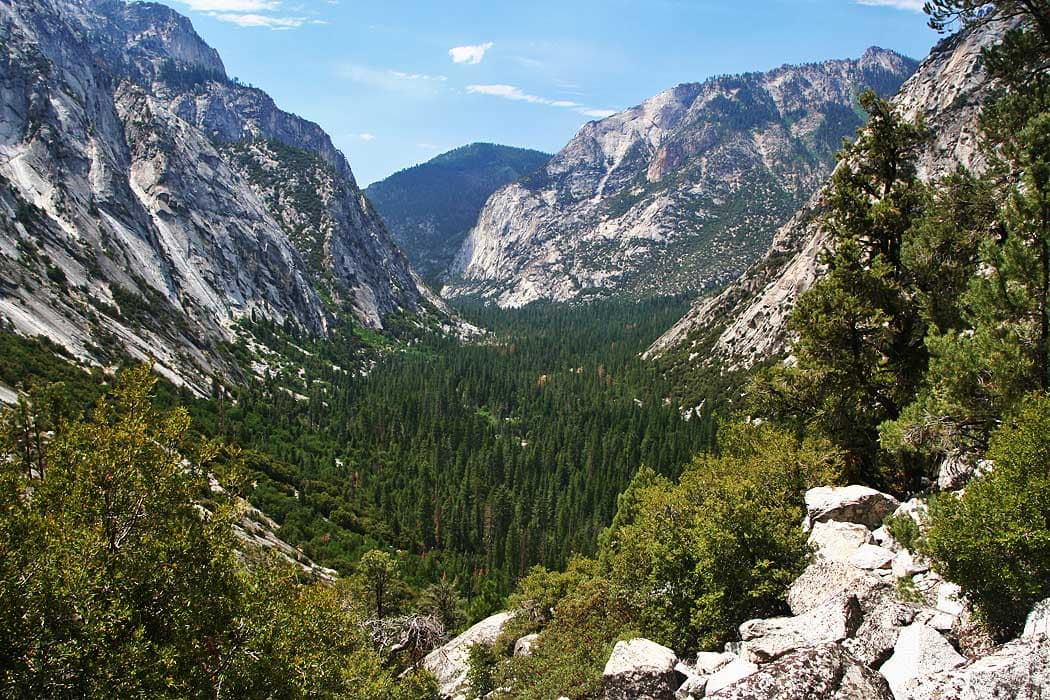
Kings Canyon is the quieter park, and most of its drama sits in Cedar Grove, about 30 miles into the canyon on Highway 180. The drive from Grant Grove down to Cedar Grove takes roughly 45 minutes and drops over 4,000 feet. The canyon at the bottom is one of the deepest in North America, cut by the Kings River into granite walls that rise 8,000 feet above the river.
Zumwalt Meadow is an easy 1.5-mile loop on the canyon floor, flat and surrounded by those walls. The meadow sits between the river and the vertical rock faces and gives you the full canyon effect at ground level. It is the best short walk in Kings Canyon.
Roaring River Falls is a 0.1-mile walk from a roadside pullout near Cedar Grove Village to a 40-foot waterfall. It pours hardest in spring snowmelt but stays worth a stop into summer.
Roads End at the far end of Cedar Grove is the trailhead for the Rae Lakes Loop, a 41-mile backpacking circuit through one of the finest lake basins in the Sierra. Permits are required and competitive for summer travel. If you are not backpacking, Roads End still makes a worthwhile drive to see how deep the canyon goes before the pavement ends.
Grant Grove, near the Kings Canyon entrance, holds the General Grant Tree, the second largest sequoia by volume and designated the Nation’s Christmas Tree by Congress in 1926. A short loop trail circles it and several other massive sequoias. This grove is the easiest stop in the park and works even if you only have a couple of hours before driving on.
Where to Stay
Inside the parks, Wuksachi Lodge in the Giant Forest area is the main hotel option; it books months ahead for summer. John Muir Lodge at Grant Grove is a smaller alternative in the Kings Canyon section. Both stay open year-round. Campgrounds include Lodgepole and Dorst Creek on the Sequoia side and Crystal Springs and Sentinel in Cedar Grove. Lodgepole is the most fully equipped, with flush toilets and a camp store nearby. Reserve on recreation.gov well ahead for summer weekends; Cedar Grove campgrounds run first-come, first-served on some dates.
Outside the parks, Three Rivers is the gateway town on the south side, about four miles from the Ash Mountain entrance on Highway 198. It has motels, rental houses, and a handful of restaurants. Fresno to the northwest is the closest city, about 60 miles from the parks, with full hotel inventory and the easiest airport access. If you are coming from Los Angeles, Visalia off Highway 99 works as a base, roughly 35 miles from the Ash Mountain entrance.
Getting There and Getting Around
From Los Angeles, plan 4.5 to 5 hours to the Ash Mountain entrance on Highway 198, depending on traffic leaving the city. From San Francisco, allow 4 to 4.5 hours via Highway 99 south through Fresno. Fly into Fresno Yosemite International (FAT) for the closest airport option, about 75 miles and 90 minutes from the park. A rental car is required; there is no transit to the parks from outside the area.
Inside the parks, free summer shuttles run between the main Sequoia Giant Forest sites. On peak weekends this is the only practical way to reach the Sherman Tree without a long wait. Outside the shuttle zone, you need your own vehicle.
Fuel up before entering. There is no gas inside the national park. Three Rivers has stations, and Fresno is fully stocked. The Generals Highway between the two parks has steep grades and tight curves that challenge larger RVs; know your vehicle’s limits before committing.
Cell coverage is spotty to nonexistent in much of both parks, particularly along the Cedar Grove canyon floor. Download the NPS app maps offline and carry a paper backup.
For the full High Sierra region context, including Lake Tahoe, Yosemite, and Mammoth Lakes, that page puts these parks in the larger Sierra picture. If you are choosing between California parks, the best national parks in California page ranks each one with honest trade-offs. The dedicated Sequoia National Park and Kings Canyon National Park pages each go deeper on their individual terrain. And if Yosemite is also on the list, the Yosemite first-timer’s guide covers what that visit requires before you stack a second Sierra park onto the trip.