The Pacific Coast Highway is the drive most people picture when they picture California: two lanes hugging cliffs, the ocean on one side, Big Sur unrolling ahead. The name covers several stretches of Highway 1, but the famous run is the roughly 460 miles between San Francisco and Los Angeles. Done right it is a three- or four-day trip, not a one-day sprint. Drive it in a day and you will spend it staring at the road instead of the view. Here is how to plan the route, where to stop, and how much time each leg really takes. For a night-by-night version, use the Pacific Coast Highway road trip itinerary alongside this guide.
Which Direction To Drive
Drive north to south, San Francisco to Los Angeles, and you will be in the right-hand lane on the ocean side the whole way. That means the pullouts and overlooks are yours without crossing traffic, and the coastal views sit directly out your passenger window. Every experienced Highway 1 driver tells you the same thing, and it matters more here than on most roads because the shoulders are narrow and the turnouts fill fast. Going the other way, you spend the whole drive fighting across the oncoming lane to reach every viewpoint, and on a road with blind curves and cyclists that is not worth the trouble. The only reason to drive south to north is if your flights force it, and even then, plan to stop only at the pullouts on your side.
Start in San Francisco, spend a day on the California classics if you have not already, then head south. You can pick up Highway 1 near Pacifica and follow it down the coast, past the Devil’s Slide tunnels and the surf breaks at Half Moon Bay into Santa Cruz, an easy 90 minutes that eases you into the rhythm before the big scenery starts. Santa Cruz itself is worth an hour for the beach boardwalk and its old wooden roller coaster before you push on to the Monterey Peninsula. For a planner that goes deeper on the road itself, the driving Highway 1 guide covers closures, fuel stops, and the section-by-section detail.
The Best Stops, North To South
The heart of the drive is the Monterey Peninsula and Big Sur. Plan your stops around these and you cannot go wrong.
- Monterey and Carmel. Cannery Row and the Monterey Bay Aquarium are worth a half day, and the aquarium is one of the best in the country for a reason (adult admission runs about $60, and reserving a timed ticket online saves the line). Carmel-by-the-Sea is a walkable village of galleries and beaches just south. If you have the time and about $12, the 17-Mile Drive through Pebble Beach loops past Lone Cypress and the golf resorts between Monterey and Carmel. Just past Carmel, Point Lobos State Natural Reserve has short cliff trails and some of the clearest water on the coast for $10 per vehicle.
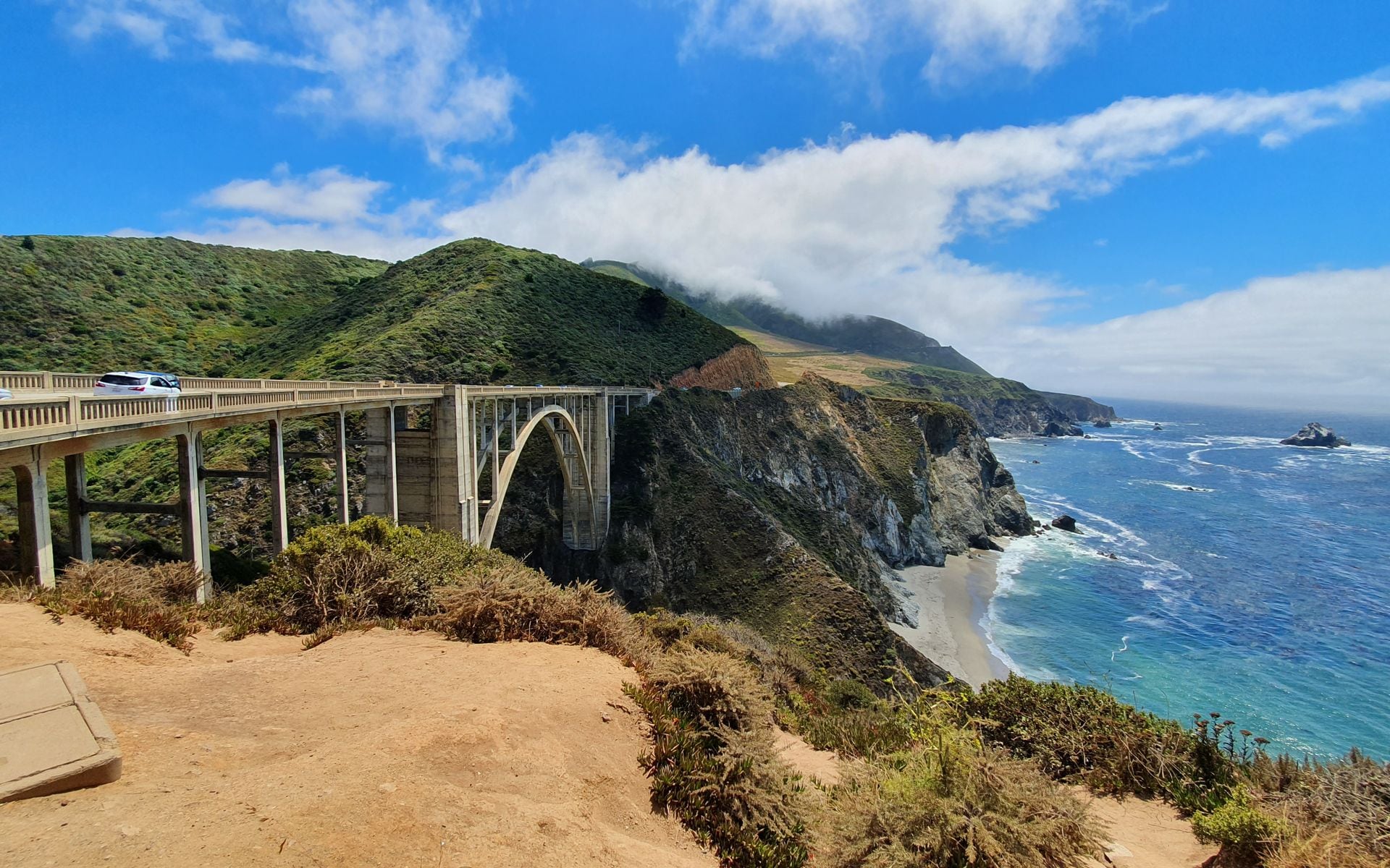
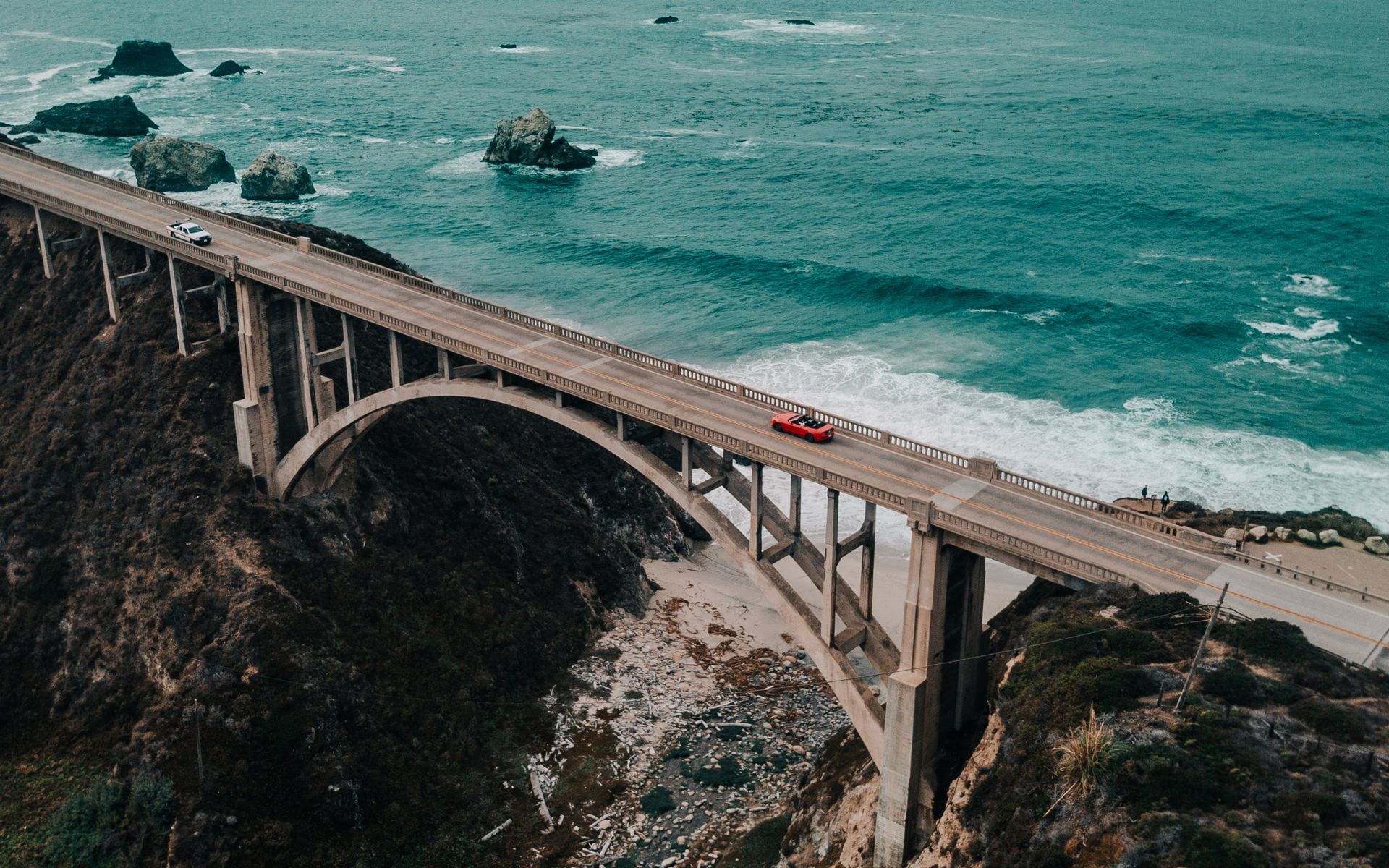
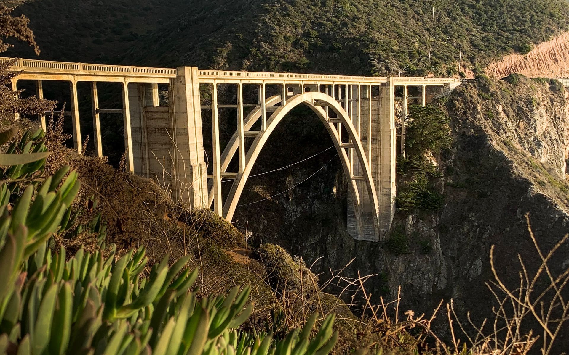
- Big Sur. This is the postcard. Bixby Creek Bridge is the photo everyone takes, and just south you hit Pfeiffer Big Sur State Park, the purple-sand beach at Pfeiffer Beach (a narrow, easy-to-miss turn down Sycamore Canyon Road, $12 to park), and McWay Falls in Julia Pfeiffer Burns State Park, an 80-foot waterfall dropping onto a cove beach. Stop for lunch at Nepenthe, perched 800 feet above the water, or coffee at the Big Sur Bakery, and give Big Sur most of a day. Cell service disappears here, so download your maps first.
- San Simeon and Cambria. Hearst Castle sits above San Simeon, with tours from about $30 per adult that you should book ahead through the California State Parks reservation system. A few miles north, the Piedras Blancas rookery puts thousands of elephant seals on the beach just off the highway, free to watch from the boardwalk, and they are hauled out in the biggest numbers from December through March.
- Morro Bay to Santa Barbara. Morro Rock, a 576-foot volcanic plug, marks the turn where the drama softens into easy beach towns. Pismo Beach, San Luis Obispo, and finally Santa Barbara with its red-roofed downtown, Stearns Wharf, and long beaches make the gentle finish before the run into Los Angeles.
Drive Times And Distances
The whole route is about 460 miles, but the number that matters is how slow the good part is. Plan on these rough legs:
- San Francisco to Monterey: about 2.5 hours (without Highway 1 stops).
- Monterey through Big Sur to San Simeon: about 3 to 4 hours of driving, but budget most of a day for stops. This stretch is winding and often 25 to 35 miles per hour.
- San Simeon to Santa Barbara: about 3 hours.
- Santa Barbara to Los Angeles: about 2 hours on U.S. 101, longer if you hit the Ventura and Los Angeles traffic in the afternoon.
Big Sur is where people blow their timing. It is only about 90 miles from Carmel to San Simeon, but with the curves, the turnouts, and the photo stops it eats four or five hours easily. Never plan to drive Big Sur after dark. There are no lights, the drops are real, and you miss the entire point.
A Sample Three-Day Plan
If you want the drive laid out by night, here is the version that works for most people, and it lines up with the Pacific Coast Highway road trip itinerary if you want more detail.
Day one: leave San Francisco mid-morning, drive to Monterey (about 2.5 hours direct), and spend the afternoon on Cannery Row and at the aquarium. Sleep in Monterey or Carmel. Day two is the big one: leave early, drive the 17-Mile Drive or head straight to Point Lobos, then take Big Sur slowly, Bixby Bridge, Pfeiffer Beach, Nepenthe for lunch, McWay Falls, and roll into San Luis Obispo or Cambria for the night. That is only about 130 miles but a full day with stops. Day three: see the elephant seals at Piedras Blancas and tour Hearst Castle in the morning, then finish through Morro Bay and Pismo Beach to Santa Barbara for the night, or push the last two hours down U.S. 101 into Los Angeles.
Reverse it if you are starting in Los Angeles, but remember you lose the ocean-side lane advantage going north. Most people who drive it the wrong direction wish they had not.
Where To Stay And Eat
Break the drive with at least two overnight stops. Monterey and Santa Barbara are the natural bookends. In Monterey, the Monterey Plaza Hotel and Spa sits right on the water at Cannery Row, and the InterContinental The Clement is a step up the street. Big Sur itself has a handful of lodges (the Big Sur River Inn, Glen Oaks Big Sur, and the pricey Post Ranch Inn and Ventana) that book out months ahead and run expensive, so many travelers sleep in Monterey or San Luis Obispo instead and drive Big Sur in daylight between them. Camping at Pfeiffer Big Sur State Park is the budget alternative, but those sites reserve out fast for summer weekends. For food, Nepenthe in Big Sur is the classic view lunch, and the roadhouse burgers at the Big Sur River Inn or a stop at the Big Sur Bakery break up the drive. In the Central Coast towns, the markets and taquerias of San Luis Obispo and the seafood on Santa Barbara’s Stearns Wharf keep the rest easy. Coastal California is not a budget trip, and if the costs are catching you off guard, the is California expensive to visit breakdown lays out what to expect.
Before You Go
Two things will make or break the trip. First, check for road closures. Highway 1 through Big Sur closes periodically for landslides and repairs, sometimes for months. The Rat Creek washout closed the road for most of 2021, and the Regent’s Slide and Rocky Creek slides have forced one-way traffic-signal sections since. Caltrans posts current status on its QuickMap site, and you need to know before you commit, because a closure at Big Sur means backtracking inland to U.S. 101 and skipping the best part. Second, get the timing right. The best time to drive Highway 1 is generally September and October, when the summer fog thins out and the crowds fade, and you should weigh that against the wider best time to visit California.
A few practical notes for the drive itself. Gas is scarce and expensive through Big Sur, so fill up in Monterey or Carmel and again in Cambria or San Luis Obispo rather than trusting the one or two pricey stations mid-canyon. Cell coverage drops out for most of the Big Sur stretch, so download offline maps before you leave town. The turnouts are the whole point of driving north to south: use them, pull all the way off the road, and never stop in the traffic lane for a photo, because the locals behind you drive this at speed. Pack a layer even in summer, since the coast can sit 20 degrees cooler than inland. Above all, take the whole thing slower than you think you need to. The drive is the destination here, not the miles.