The Coast: Highway 1 and Big Sur
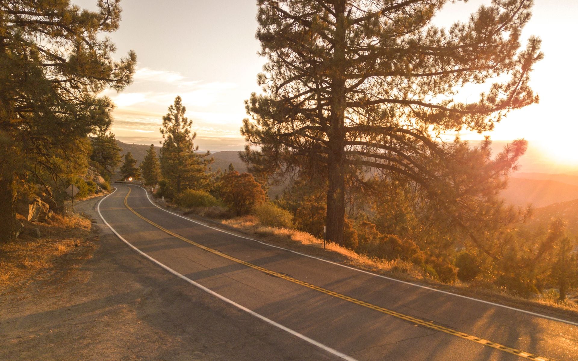
The coast drive is the one everyone comes for, and it lives up to it. Highway 1 along Big Sur, between Carmel and San Simeon, threads the edge of the continent past the Bixby Creek Bridge, cliff-top pullouts, and the waterfall-onto-the-beach at McWay Falls. This 90-mile stretch takes a full unhurried day with stops, and it is the heart of any Central Coast trip.
The full Pacific Coast Highway runs far beyond Big Sur, from Mendocino in the north down to Orange County, hugging the ocean nearly the whole way. Doing the classic San Francisco to Los Angeles stretch on Highway 1 takes about 9 to 10 hours of pure driving versus 6 hours on the inland I-5, which is exactly why you give it two or three days instead of one. Our Pacific Coast Highway road trip breaks it into a day-by-day plan.
One caution: Big Sur's Highway 1 periodically closes for landslides and repairs, sometimes for months at a time, so check the current road status before you commit to that leg. When it is open, it is the best coastal drive in the country. The beaches along the way are covered in our best beaches in California guide.
The Mountains: Sierra Crest Drives
The Sierra Nevada has spectacular drives, but they run on a short season. Tioga Road, Highway 120 over the crest of Yosemite, climbs to nearly 10,000 feet past Tenaya Lake and Tuolumne Meadows, and it is one of the great alpine drives in America. It typically opens late May or June and closes with the first heavy snow, usually by November, so it is a summer-and-fall road only.
Highway 395 down the Eastern Sierra is the other great mountain drive and, unlike Tioga, it stays open all year. It runs along the base of the range past Mono Lake, the Mammoth turnoff, and the 14,000-foot peaks around Mount Whitney, with the Sierra wall rising thousands of feet right beside the road. It is the scenic way between Lake Tahoe country and the desert parks.
Around Lake Tahoe, Highway 89 along the west shore past Emerald Bay is a short, high-payoff drive that many pair with a ski trip; see our skiing and snowboarding guide for the winter side. Mountain driving demands respect: carry tire chains in winter, watch for closures, and know that snow can shut these roads with little warning.
The Deserts and the Redwoods
The desert has drives you cannot get anywhere else. In Death Valley, the one-way Artists Drive loops through hills streaked pink, green, and gold from mineral deposits, and the road down to Badwater Basin crosses the lowest ground in North America. These drives are best October through April; in summer the pavement radiates heat well past 120°F and you watch your fuel range carefully, since gas stations are far apart.
The Palms to Pines Highway climbs from the desert floor near Palm Springs up into pine forest in a single dramatic ascent, a good half-day loop. Down near Joshua Tree, the park road itself is a scenic drive through boulder fields and Joshua-tree forest that many visitors experience mostly from the car.
In the far north, the Avenue of the Giants parallels Highway 101 for 31 miles through the tallest trees on Earth in Humboldt Redwoods State Park. It is slow, shaded, and quiet, a completely different mood from the coast or the desert. Guided versions of many of these drives, from wine-country tours to park excursions, are available through the operators in our tour operators and guides directory if you would rather not drive them yourself.
When to Drive What
The single rule that governs California drives is that the mountain roads are seasonal and the coast and desert are not. Tioga Road and other high Sierra passes are open only from roughly late spring through fall. Highway 395 and the coast run year-round. The desert drives are best in the cool months and hazardous in summer heat. Plan the route around what is open on your dates.
Weather shapes the coast too. Summer mornings on Highway 1 can be socked in with fog that hides the very views you came for, often burning off by midday, while fall frequently brings the clearest coastal driving weather of the year. The desert is the reverse, glorious in winter and spring and dangerous in the summer.
Traffic matters on the drives near the cities. The coast approaches to Los Angeles and San Francisco clog on weekends and holidays, so time your city legs for off-peak hours. The rural stretches, Big Sur, Highway 395, the desert roads, are more about slow, careful driving on winding two-lane pavement than about traffic.
Planning a Driving Trip
A rental car is required for all of this; there is no transit substitute for the scenic roads. Fill the tank before remote legs like Highway 395, Death Valley, and the Big Sur coast, where services are sparse and expensive. Give the winding roads more time than a map suggests, since the posted mileage hides how slow the curves really are.
String the drives together with the rest of your trip rather than treating them as separate. A coastal road trip can fold in a beach day, a whale-watching morning, and, near the southern end, a stop at the region's theme parks. A Sierra loop can pair Tioga Road with Yosemite hiking and a Tahoe drive.
For the big-picture routing, how the coast, the mountains, and the desert connect, start at the California travel guide. Then build your drive around the seasons: coast and desert anytime with the weather in mind, and the high mountain roads only when they are open.
Frequently asked questions
What is the best scenic drive in California?
Highway 1 through Big Sur, between Carmel and San Simeon, is the classic, a cliff-edge coastal road past the Bixby Creek Bridge and McWay Falls. For the mountains, Tioga Road over Yosemite's crest and Highway 395 down the Eastern Sierra are the standouts. Big Sur periodically closes for landslides, so check the road status first.
When does Tioga Road in Yosemite open?
Tioga Road (Highway 120 over the Sierra crest) typically opens in late May or June and closes with the first heavy snow, usually by November. It is a summer-and-fall road only. If you are visiting in winter or early spring, plan around it being closed.
How long does the Pacific Coast Highway drive take?
Driving Highway 1 from San Francisco to Los Angeles takes about 9 to 10 hours of pure driving, versus 6 hours on the inland I-5. Because of the scenery and the stops, give it two or three days rather than trying to do it in one long push.
Do I need a special vehicle for California's scenic drives?
A standard rental car handles nearly all of them, including Big Sur, Highway 395, and the paved desert park roads. In winter, the Sierra roads may require tire chains. Fill your tank before remote legs like Highway 395 and Death Valley, where gas stations are far apart and pricey.